

Uttarakhand Genome Project Community
Discover the unique Uttarakhand genetics & rich ancestry of Devbhoomi's people. Explore the geography, history, and diverse populations of Garhwal and Kumaon.
UTTARAKHAND GENOME PROJECT
Geography, People, History, and Genetics of the Land of the Gods
1. Introduction: Who Are the People of Uttarakhand?
Uttarakhand, literally the “Northern Land,” is not a single ethnicity or caste group but a geography-defined population in the genealogical sense: the inhabitants, past and present, of a rugged Central Himalayan state carved out of Uttar Pradesh in November 2000. Popularly known across India as Devbhoomi, the “Land of the Gods,” for its density of temples, shrines, and pilgrim routes, the state is home to just over ten million people according to the 2011 Census, spread across two historically distinct but closely related cultural regions — Garhwal in the west and Kumaon in the east. This profile treats “Uttarakhand” as a geography-of-origin community: the shared population of a defined Himalayan territory, encompassing its many castes, sub-regions, and linguistic groups, whose ancestors have farmed terraced hillsides, tended temples, and sent generations of soldiers and migrants down to the plains for centuries.
Bordered by Tibet (China) to the north, Nepal to the east, Uttar Pradesh to the south, and Himachal Pradesh to the northwest, Uttarakhand sits astride some of the highest and most sacred terrain in the subcontinent. Its towns and shrines — Haridwar, Rishikesh, Badrinath, Kedarnath, Gangotri, Yamunotri, Nainital, and Almora — have for over a thousand years served as gateways to pilgrimage, seats of small Himalayan kingdoms, and, more recently, hill stations and cantonments of colonial and post-colonial India. The region is at once the traditional source of the Ganga and Yamuna rivers, the ground on which the Katyuri, Panwar (Garhwal), and Chand (Kumaon) dynasties built their kingdoms, and a landscape whose people have long balanced subsistence hill agriculture against a steady, centuries-old current of out-migration to the plains, to the army, and to the wider world.
2. Geography
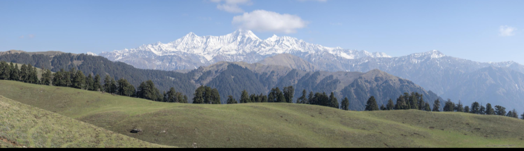
Uttarakhand covers 53,483 square kilometres, making it a comparatively compact Himalayan state, and it is almost entirely mountainous: roughly 86 per cent of its area is classified as hill terrain and about 65 per cent is under forest cover, among the highest proportions of any Indian state. The terrain rises from the narrow Bhabar and Terai belt along the Uttar Pradesh border, through the Shivalik and Lesser Himalayan ranges where most towns and terraced farmland sit, into the Greater Himalayan zone of permanent snow and glaciers — including Nanda Devi (7,816 m), the second-highest peak in India, and the glacial sources of the Ganga at Gangotri and the Yamuna at Yamunotri. The state's two great rivers, the Bhagirathi-Ganga and the Alaknanda, meet at Devprayag to form the Ganga proper, and their successive confluences upstream — the Panch Prayag of Vishnuprayag, Nandprayag, Karnaprayag, Rudraprayag, and Devprayag — are themselves major pilgrimage sites.
Uttarakhand is administratively divided into two divisions and thirteen districts, with Dehradun serving as the winter capital and seat of government and Gairsain designated as a proposed summer capital; the state high court sits at Nainital. Haridwar is the most populous district and the principal urban and industrial centre of the low-lying Terai, while Rudraprayag, deep in the mountains, is the least populous. Long before these administrative lines were drawn, however, the people of the hills identified themselves with two older cultural regions, each with its own dialect, cuisine, and historical character.
3. Origins and Early History
3.1 Prehistoric and Vedic Foundations
Human habitation of the Uttarakhand Himalayas reaches back to the Paleolithic and Mesolithic periods, attested by rock shelters and petroglyphs in the Kumaon foothills. During the Vedic age the region is generally identified with the fringes of the Kuru and Panchala kingdoms, and community tradition holds that sages and seers of the Vedic and epic period retreated to its forests and river valleys for meditation — a memory preserved in place names and in the region's enduring identity as a land of ashrams and pilgrimage. The Puranas refer to the combined territory as “Kedarkhand” (broadly present-day Garhwal) and “Manaskhand” (broadly present-day Kumaon), terms from which the modern name Uttarakhand is itself partly drawn.
3.2 Kunindas, Katyuris, and the Rise of Regional Kingdoms
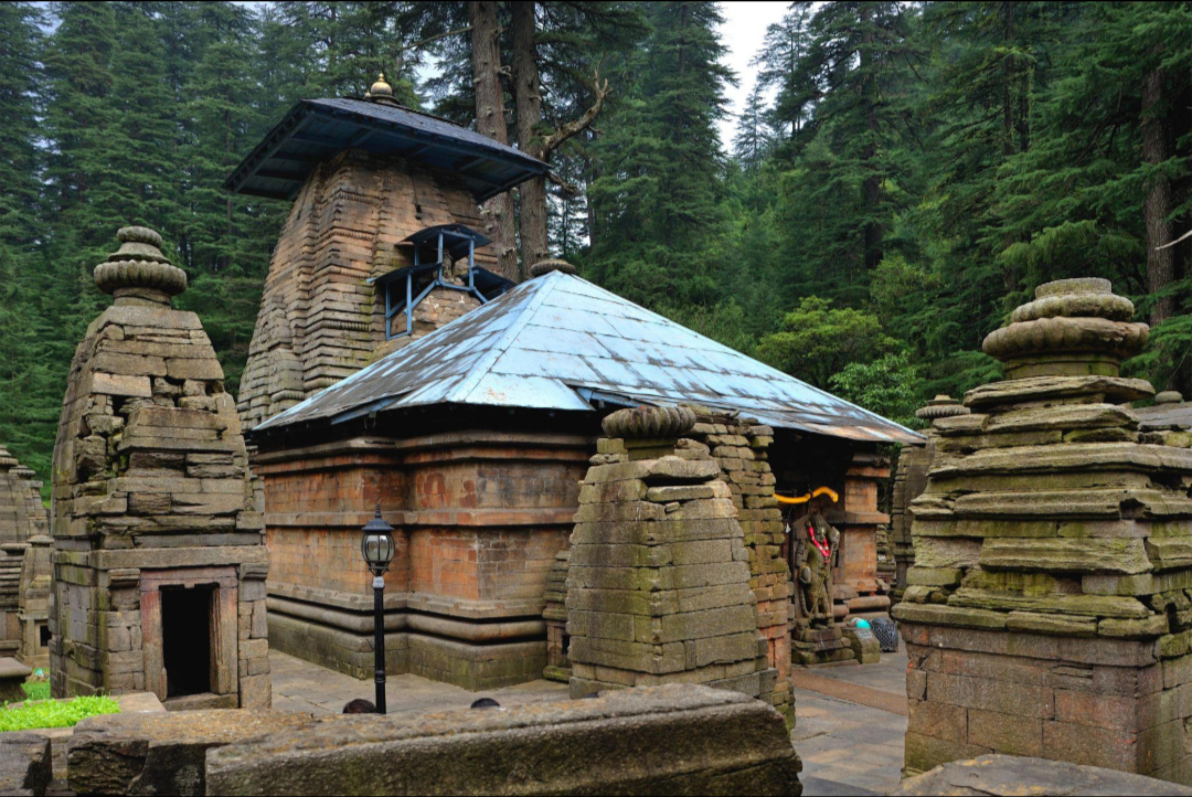
By the early centuries BCE, the Kuninda kingdom controlled much of the sub-Himalayan tract between the Beas and the Ganga, including parts of present-day Uttarakhand, and Ashokan edicts and later Gupta-era inscriptions attest to the spread of Buddhism and, subsequently, Hindu devotional practice through the hills. From roughly the 7th to the 11th centuries, the Katyuri dynasty, originating in the Katyur valley of present-day Chamoli district, became the first historical power to rule a broadly unified Uttarakhand, promoting Shaivism and building the influential Jageshwar temple complex near Almora. The fragmentation of Katyuri authority after the 11th century gave rise, in Garhwal, to as many as sixty-four small principalities (garhs) ruled by local chieftains — the origin of the very name “Garhwal,” the “land of forts.”
3.3 The Garhwal Kingdom and the Panwar Dynasty
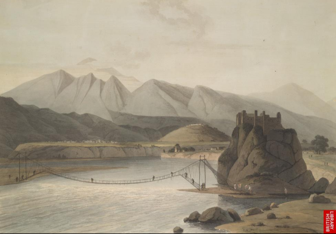
Tradition credits Kanak Pal, a prince said to have arrived from Malwa, with founding what became the Panwar (or Parmar) dynasty of Garhwal. In the late 15th century, Ajay Pal, a descendant of this line ruling from the principality of Chandpurgarh, succeeded in unifying the sixty-four garhs into a single Garhwal kingdom, subsequently shifting his capital first to Devalgarh and then, by 1519, to Srinagar (in present-day Pauri Garhwal district, not to be confused with the Kashmiri city of the same name). The Panwar dynasty, drawing on Rajput lineage, ruled Garhwal for close to three centuries, repeatedly repelling incursions from Kumaon, the Mughals, the Sikhs, and Rohilla Afghan raiders, before its sovereignty was finally broken by the Gorkha invasion of 1803–04.
3.4 The Chand Dynasty of Kumaon
Parallel to Garhwal's Panwar kings, the Chand dynasty established its rule over Kumaon, first from a capital at Champawat and later at Almora. The Chand period is widely regarded as a golden age of Kumaoni art, temple architecture, and administration, coupling martial strength with courtly patronage of forts, palaces, and shrines that still draw pilgrims and historians today. Kumaon under the Chands developed as a hub connecting Himalayan trade routes — particularly trans-border trade with Tibet — to markets on the plains, a role that shaped the region's characteristic small-town commercial culture.
3.5 The Gorkha Invasion and the Anglo-Nepalese War
From the late 18th century, Nepali (Gorkha) forces expanding westward from the Kathmandu valley annexed Kumaon by around 1790–91 and, after a fiercely resisted campaign, Garhwal by 1803–04, killing the Garhwali king Pradyumna Shah in the decisive Battle of Khurbura (1804). Gorkha rule over the following decade, remembered locally by the term Gorkhyani — now synonymous with plunder and harsh military administration — imposed heavy taxation and forced labour on the hill population. This period ended with the Anglo-Nepalese War of 1814–16: East India Company forces under commanders such as David Ochterlony drove the Gorkhas out of Garhwal and Kumaon, and the Treaty of Sugauli (1816) fixed the region's boundaries substantially as they remain today, ceding most of the hills to British control while restoring a truncated princely Tehri Garhwal state to the old Panwar line.
3.6 British Rule and the Path to Statehood
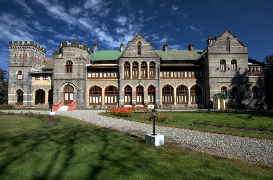
Under British administration, Kumaon and the British-controlled portion of Garhwal were governed as part of the North-Western Provinces and, from 1902, the United Provinces of Agra and Oudh, while Tehri Garhwal survived as a separate princely state until Indian independence. The colonial period brought hill-station development at Nainital, Mussoorie, Almora, and Ranikhet, Christian missionary schooling, and large-scale recruitment of Garhwali and Kumaoni men into the British Indian Army's Garhwal Rifles and Kumaon Regiment. After independence, the hill districts remained part of Uttar Pradesh, but a sustained popular movement through the 1990s — driven by grievances over neglect of hill development, migration, and cultural distinctiveness — culminated in the creation of the state of Uttaranchal on 9 November 2000, renamed Uttarakhand in 2007.
4. Demographic Profile
Uttarakhand's 2011 Census population stood at 10,086,292 (some sources cite 10,116,752), making it the 20th most populous Indian state despite its comparatively small area — about 0.83 per cent of India's population. Population density is low by Indian standards, at roughly 189 persons per square kilometre, but this masks a sharp internal divide: about 65 per cent of residents live in the hills, at far lower densities, while the remaining plains population, concentrated in Haridwar and Udham Singh Nagar, is far more densely settled (Haridwar district alone records over 800 persons per square kilometre). The state's overall sex ratio was 963 females per 1,000 males in 2011 — notably higher than the national average, a pattern often linked to the long-standing out-migration of working-age men — while the child sex ratio, at 890, follows the more typical Indian pattern. Literacy stood at 78.8 per cent (87.4 per cent male, 70.0 per cent female), above the national average.
Religiously, Uttarakhand is predominantly Hindu (around 83 per cent as of the 2011 Census), with a significant Muslim minority (around 14 per cent, concentrated substantially in the Terai districts of Haridwar and Udham Singh Nagar) and small Sikh, Jain, Buddhist, and Christian communities. A distinctive feature of the state's social structure is the historically high proportion of Brahmins and Rajputs among the Garhwali and Kumaoni Hindu hill population, alongside Scheduled Caste communities and small numbers of Scheduled Tribes such as the Bhotiya, Jaunsari, Tharu, and Buksa, concentrated respectively in the high Himalayan borderlands, Jaunsar-Bawar, and the Terai. Uttarakhand is also unusual among Indian states in having designated Sanskrit as one of its official languages, alongside Hindi.
5. Genetics and DNA Ancestry
As a semi-isolated Himalayan population with a long history of both endogamous hill settlement and a role as a corridor for trans-Himalayan and plains contact, Uttarakhand offers population geneticists a genetically layered, rather than uniform, picture.
5.1 The Ancestral North Indian – Ancestral South Indian Gradient
Like the great majority of Indian populations, the people of Uttarakhand descend from a mixture of two deeply diverged ancestral populations: Ancestral North Indians (ANI), related to Central Asian, Middle Eastern, Caucasian, and European populations, and Ancestral South Indians (ASI), indigenous to the subcontinent and not closely related to any population outside it. Genome-wide studies estimate that this ANI–ASI admixture occurred roughly 1,900 to 4,200 years ago across India. As a Gangetic-adjacent, Indo-Aryan-speaking hill population with historically high proportions of Brahmin and Rajput lineages, Uttarakhand's Hindu hill communities characteristically show a comparatively high ANI component relative to populations further south and east on the Gangetic plain, consistent with the region's long-claimed genealogical links to migrant priestly and warrior lineages arriving from the plains over the last two millennia, layered onto a much older indigenous Himalayan and ASI-linked base.
5.2 Regional Genetic Studies
Direct population-genetic surveys of Uttarakhand emphasise the state's semi-isolated Himalayan geography as an unusually favourable setting for studying genetic structure. A study of red-cell enzyme polymorphisms across Uttarakhand's caste and tribal populations, published shortly after the state's creation, found some of the highest recorded frequencies of certain glucose phosphate isomerase (GPI) variants of any population studied worldwide, and concluded that the state's various caste and tribal groups show considerable internal genetic variation rather than a single homogeneous signature — a pattern the researchers linked to the historically endogamous, geographically compartmentalised nature of hill settlement. Separately, a genome-wide comparison of scheduled and backward-caste communities across North India found that the Syon community of Uttarakhand showed the closest genomic affinity, among sampled North Indian populations, to the geographically distant Kumhar potter community of the wider Gangetic belt — illustrating how caste-based endogamy can produce genetic clustering that cuts across simple geography.
5.3 Y-Chromosome and Deep Ancestry
Broader studies of North Indian and Himalayan-fringe Y-chromosome (paternal) lineages find hill populations such as those of Uttarakhand carrying a mix of deeply rooted South Asian haplogroups (including H and L) alongside haplogroup R1a, associated with the spread of Indo-Aryan-speaking populations, at proportions that are often elevated among the region's Brahmin and Rajput lineages relative to Scheduled Caste and tribal groups of the same hills. Mitochondrial (maternal-line) lineages across the wider Himalayan belt also show a modest but detectable presence of East and Central Asian-linked haplotypes among tribal groups such as the Bhotiya, reflecting the region's historic role as a trans-Himalayan trade and settlement corridor connecting the Gangetic plain to Tibet.
6. Language and Literature
Hindi and Sanskrit are Uttarakhand's official languages, but everyday hill speech is carried chiefly by two closely related Central Pahari languages: Garhwali, spoken by roughly 2.3 million people across most of the Garhwal division, and Kumaoni, spoken across the Kumaon division. Both are written in Devanagari and are recognised as distinct languages by linguists, though official policy has historically classified them as Hindi dialects, a source of longstanding cultural debate. Smaller indigenous languages include Jaunsari (in the Jaunsar-Bawar tract of Dehradun district), the Sino-Tibetan Jad and Rongpo languages spoken by small trans-Himalayan trading communities in Uttarkashi and Chamoli, and, among migrant populations of the Terai, Punjabi, Urdu, and Nepali. Garhwali and Kumaoni both possess rich oral and increasingly written literary traditions, spanning devotional poetry, folk ballads, and, since the 20th century, a modern regional press and cinema.
7. Religion, Festivals, and Pilgrimage
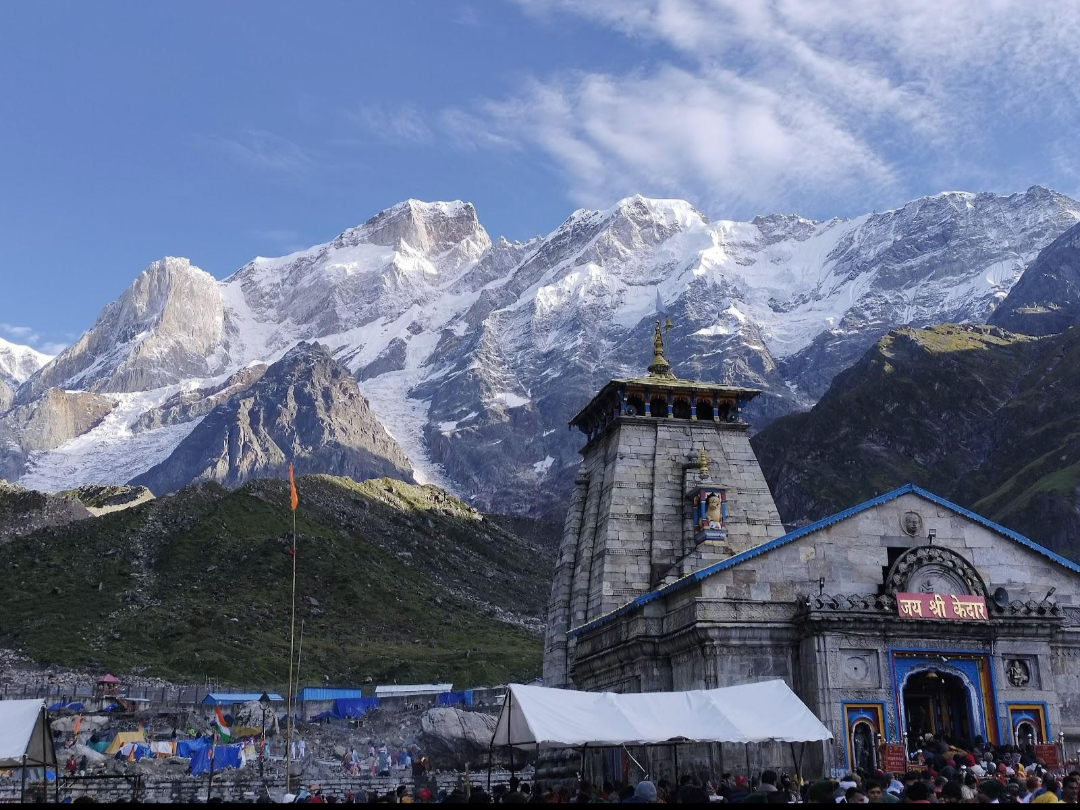
Uttarakhand is one of Hinduism's most sacred geographies, popularly known across India simply as Devbhoomi. The Char Dham — Yamunotri, Gangotri, Kedarnath, and Badrinath — form one of Hindu India's most important pilgrimage circuits, drawing millions of pilgrims each season to the glacial sources of the Yamuna and Ganga and to the Himalayan shrines of Shiva and Vishnu; Kedarnath and Badrinath are further reckoned among the twelve Jyotirlingas and the char dham of the wider all-India pilgrimage respectively. Haridwar and Rishikesh, at the point where the Ganga leaves the mountains for the plains, are major centres of ritual bathing, yoga, and ashram life, and Haridwar hosts the Kumbh Mela on its periodic rotation. The Panch Kedar and Panch Badri temple groups, along with Jageshwar's ancient Shiva temple cluster and Nanda Devi — revered as a goddess and the state's highest peak — round out a dense sacred landscape. Small but historically rooted Muslim, Sikh, and Christian communities, concentrated in the Terai and in colonial-era hill stations, observe Eid, Gurpurabs, and Christmas alongside the Hindu festival calendar. Major festivals include Diwali, Holi, Makar Sankranti (locally Ghughutia or Kale Kauva in Kumaon), and two festivals distinctive to the region: Harela, a Kumaoni festival marking the sowing season and the arrival of the monsoon, celebrated by growing and later cutting small pots of seedlings; and Phool Dei, a Garhwali spring festival in which young girls scatter flowers at doorways to welcome the new season.
8. Culture, Customs, and Social Practices
Social life in the Uttarakhand hills has historically been organised around small, close-knit villages, joint or extended family households, and a caste hierarchy dominated numerically and socially by Brahmin and Rajput (Thakur) lineages, alongside artisan and service castes and Scheduled Caste communities such as the Shilpkars. Land is traditionally worked in small, terraced, rain-fed and irrigated plots, and cooperative labour-sharing customs — such as the Garhwali paintya and the wider North Indian tradition of collective harvest and house-building assistance — remain socially significant in many villages. Hospitality toward guests and travellers is a strongly held hill value, reinforced by the region's long-standing role as a pilgrimage corridor. A defining thread of modern regional identity is the memory of the Chipko movement of the 1970s, in which Garhwali villagers, many of them women led by figures such as Gaura Devi, embraced trees to prevent commercial felling — an act of nonviolent forest protection that became a global touchstone of grassroots environmentalism and remains a source of considerable regional pride.
Folk theatre and ritual performance carry significant social weight: the Ramlila is performed across the hills much as elsewhere in North India, while distinctively Himalayan traditions include the Pandav Lila of Garhwal, a ritual dance-drama re-enacting episodes of the Mahabharata believed by many hill communities to be their own ancestral history, and jagar, a nocturnal ritual of spirit and deity invocation performed by hereditary specialists to address illness, disputes, or misfortune within a household or village.
9. Marriage and Wedding Traditions
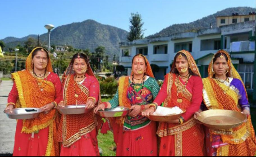
Hindu weddings in the Uttarakhand hills follow the broad North Indian Vedic pattern — including tilak (betrothal), a haldi (turmeric) ceremony, the baraat procession, saat phere (seven circuits of the sacred fire), and vidaai (the bride's farewell) — but carry distinctive Garhwali and Kumaoni inflections, including locally composed wedding songs (byaah ke geet) traditionally sung by women of the household and neighbourhood, and, in many communities, a preference for arranging marriages within one's own caste but outside one's own village or clan (gotra) to maintain exogamous kinship rules. Bride-price and dowry customs vary considerably by caste and community, and among the Jaunsari of the Jaunsar-Bawar tract, historic customary practices — including, in some lineages, forms of fraternal polyandry — have long marked out a socially distinct marriage system, though such practices have declined sharply with modernisation and legal reform. Among the small Muslim population of the Terai, the nikah tradition prevails, with a mehr settlement and walima reception, often incorporating regionally shared North Indian customs such as mehndi.
10. Cuisine
Uttarakhand's food culture reflects its hill ecology: short growing seasons, terraced dry-land farming, and a historic reliance on hardy millets, legumes, and dairy rather than the rice and wheat surpluses of the plains. Ghee, curd, and buttermilk feature heavily, and many dishes are deliberately low in oil and spice by North Indian standards, reflecting both the region's largely vegetarian Brahmin-Rajput culinary tradition and simple, functional hill cooking suited to a physically demanding agricultural and pastoral life.
10.1 Garhwali Cuisine
Garhwali cooking is built around dishes such as kaphuli (a yogurt-and-gram-flour curry), chainsoo (a slow-cooked, roasted black gram dal), thhatwani (a lentil-and-buttermilk preparation), and baadi (a mandua/finger-millet flour porridge served with curd). Aaloo ke gutke, spiced pan-fried potatoes, and jhangore ki kheer, a sweet pudding made from barnyard millet, are widely eaten staples and festive dishes respectively.
10.2 Kumaoni Cuisine
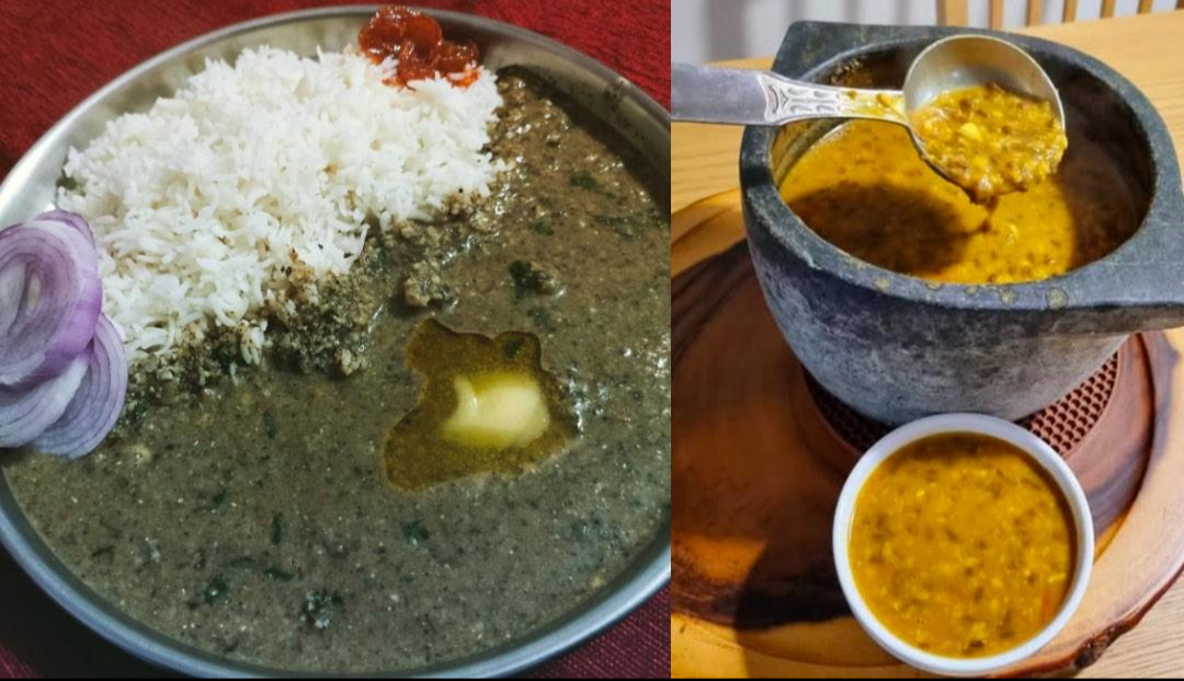
Kumaoni cuisine shares much of this millet-and-lentil base but is particularly known for bhatt ki dal (a black soybean dal), bhang ki chutney (a chutney made from roasted hemp/cannabis seeds, used purely as a spice, not a narcotic), dubuk (a steamed lentil-and-vegetable preparation), and gahat (horse gram) dishes prized for their use in the cold winters of the higher Kumaon valleys. Kumaoni raita, made with roasted and ground cucumber or radish, and a wide repertoire of dishes built on locally grown madua (finger millet) and jhangora (barnyard millet) round out a cuisine shaped by the same high-altitude farming constraints as its Garhwali counterpart.
Across both regions, everyday staples include mandua and jhangora rotis, rice and dal in the lower valleys, seasonal hill vegetables, and a wide variety of pahadi achaar (hill pickles), while the state's alpine meadows and forests also supply seasonal foraged foods such as wild mushrooms (gucchi in the high valleys) and various local greens (koda, lingda, and kaafal berries).
11. Traditional Dress and Ornaments
Traditional Garhwali and Kumaoni women's dress centres on the ghagra-choli-pichaura ensemble: a long, often pleated skirt (ghagra), paired with a choli (blouse) and a pichaura or orhni, a distinctive tie-dyed or printed veil-cum-shawl traditionally worn over the head and shoulders, particularly for ceremonial occasions. The saree and salwar-kameez are also widely worn in everyday and urban contexts today. Heavy silver and gold jewellery remains an important marker of married status and festive dress: the nathuli (a large, ornate nose ring), hansuli (a rigid neck ornament), and pichoda or guloband (a choker-style necklace) are among the most recognisably regional pieces, often passed down within families as part of a bride's stridhan (personal wealth).
Men traditionally wear a kurta-pyjama with a distinctive Garhwali or Kumaoni cap, though the Gandhi cap and turban are also seen in various communities, and the achkan or sherwani appears on formal occasions among landed and priestly families. In the Jaunsar-Bawar tract, the Jaunsari community maintains a visibly distinct dress tradition, including a heavier woollen wrap-style garment suited to the region's higher altitude and colder climate. Woollen shawls and blankets — chutka and thulma, hand-woven from local sheep's wool — are a practical and culturally significant item of both everyday and ceremonial dress across the colder upper valleys of both Garhwal and Kumaon.
12. Traditional Housing and Architecture
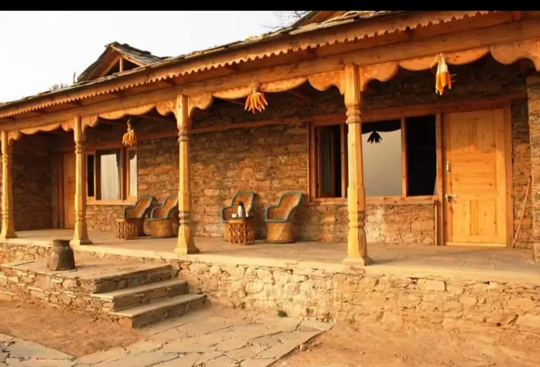
Traditional Garhwali and Kumaoni houses are typically built of stone and slate, or of mud and timber in lower-altitude villages, with sloped slate or wooden-shingle roofs designed to shed heavy monsoon rain and, at higher elevations, snow. Homes are commonly two-storeyed, with livestock and storage on the ground floor and living quarters above, arranged around a small courtyard, and elaborately carved wooden doors, window frames, and balconies (often called kholis) are a hallmark of well-preserved traditional Kumaoni and Garhwali village architecture, particularly around Almora and in parts of the Garhwal interior. At the monumental level, the region's temple architecture is exceptionally rich: the Katyuri-era stone temple cluster at Jageshwar near Almora, the Himalayan shrine architecture of Kedarnath and Badrinath, and the colonial-era churches, bungalows, and boarding schools of hill stations such as Nainital, Mussoorie, and Almora together represent several distinct architectural traditions layered across the same landscape.
13. Folklore, Music, and Oral Tradition
Uttarakhand's oral tradition is dominated by a rich repertoire of folk song and dance tied closely to the agricultural and pilgrimage calendar. Bedu Pako Baro Masa, a Kumaoni folk song about the wild fig (bedu) tree ripening through the twelve months of the year, has become something close to an unofficial anthem of the Kumaon hills, while jhoda and chholiya are widely performed Kumaoni group dances, the latter historically a sword dance performed at weddings. The Pandav Lila and jagar traditions noted above sit alongside a large body of devotional and seasonal folk songs, many performed by women, and hereditary bards and balladeers historically carried genealogical and heroic narratives — including tales of local folk heroines such as the Garhwali warrior Tilu Rauteli — from village to village long before these stories were written down.
14. Education, Livelihoods, and Socioeconomic Profile
Historically an overwhelmingly agrarian and pastoral hill economy, dependent on terraced dry farming, sheep and goat herding, and seasonal trans-Himalayan trade, Uttarakhand's economy has shifted markedly since statehood toward services, tourism, hydropower, and, in the Terai belt around Haridwar, Rudrapur, and Kashipur, manufacturing drawn by state industrial incentives. Tourism and pilgrimage — anchored by the Char Dham circuit, hill stations, and adventure and wellness tourism around Rishikesh — form a major share of the state's service economy. Uttarakhand also carries a long-standing and highly distinctive occupational tradition: since the colonial period, the hills have supplied a disproportionate share of recruits to the Indian Army, particularly the Garhwal Rifles and Kumaon Regiment, and military service remains one of the most socially prestigious livelihoods for young men from hill villages. The state's literacy rate (78.8 per cent in 2011) is above the national average, reflecting a longstanding emphasis on schooling reinforced by colonial-era missionary and cantonment-town education.
15. Diaspora and Migration
Unlike several other major Indian regional communities, Uttarakhand's most historically significant migration story runs not overseas but downhill — a phenomenon locally termed palayan (“exodus”). Since the colonial period, hill villages have sent successive generations of men into the Indian Army (above all the Garhwal Rifles and Kumaon Regiment), into government and railway service on the plains, and, from the mid-20th century onward, into private-sector jobs in Delhi, Dehradun, and other cities, leaving many hill villages with sharply skewed sex ratios and, in the most extreme cases, largely emptied of working-age residents — so-called “ghost villages” that have become a recurring subject of state policy concern and news reporting in recent years. State commissions have documented tens of thousands of such migrants over the past decade, and the government periodically convenes conferences aimed at reversing this trend and encouraging return investment.
A second, smaller and more recent thread is genuine international emigration: professionals, students, and, in earlier generations, army veterans and their families from Garhwali and Kumaoni backgrounds settled in the United Kingdom, the Gulf states, and North America over the 20th and 21st centuries, maintaining regional cultural associations, Garhwali and Kumaoni cultural societies, and periodic “Pahari” diaspora gatherings abroad. Uttarakhand's population also includes, distinct from this outward migration, a resident Indian Gorkha community of Nepali origin — numbering just over 106,000 in the 2011 Census — reflecting the state's proximity to Nepal and its own long history of Gorkha military and administrative presence in the hills.
16. Prominent Figures
16.1 Political and Public Life
- Govind Ballabh Pant (1887–1961) — born in Almora district; leading freedom fighter, first Chief Minister of the united Uttar Pradesh, and later Union Home Minister.
- Pushkar Singh Dhami (b. 1975) — Chief Minister of Uttarakhand from the Kumaon region.
- Murli Manohar Joshi (b. 1934) — born in the Kumaon region; veteran Bharatiya Janata Party leader and former Union minister.
- Mohan Chand Sharma (1965–2008) — Delhi Police officer from Uttarakhand, posthumously awarded the Ashoka Chakra for gallantry.
16.2 Literature, Arts, and Culture
- Sumitranandan Pant (1900–1977) — born in Kausani, Almora district; Jnanpith Award-winning Hindi poet, among the foremost figures of the Chhayavaad romantic movement.
- Mohan Upreti (1929–1997) — Kumaoni folk singer and composer, best known for popularising the classic folk song “Bedu Pako Baro Masa.”
- Pritam Bhartwan — celebrated Garhwali folk singer, often described as an elder statesman of Uttarakhand's folk-music revival.
- Madhuri Barthwal — Garhwali folk singer, composer, and Padma Shri recipient known for promoting folk music among women.
- Tom Alter (1950–2017) — born in Mussoorie; noted Indian actor, writer, and Padma Shri recipient.
- Jubin Nautiyal and Dev Negi — contemporary Bollywood playback singers of Garhwali origin.
16.3 Science, Sports, and Social Work
- Khadg Singh Valdiya (1937–2020) — eminent Indian geologist and former Vice-Chancellor of Kumaon University.
- Jaspal Rana (b. 1976) — Olympic-medal-winning sport shooter, gold medallist at the 1994 Hiroshima Asian Games.
- Gaura Devi (1925–1991) — grassroots community leader and one of the central figures of the Chipko forest-conservation movement.
- Tilu Rauteli (1661–1681) — Garhwali folk heroine and warrior, celebrated in regional oral tradition for fighting in defence of her homeland.
17. Conclusion
Uttarakhand represents a distinctive case of a Himalayan geography whose ancient scriptural memory, layered dynastic history, and modern population genetics converge on a coherent, if internally varied, regional story: an ancient corridor of Vedic and Puranic sacred geography, home in turn to the Katyuri, Panwar, and Chand kingdoms, reshaped by Gorkha conquest and British colonial administration, and forged into a modern state by a late-20th-century movement rooted in the hills' own sense of distinct identity and neglect. From the terraced fields and slate-roofed villages of Garhwal and Kumaon to the glacial shrines of the Char Dham, and from the folk ballads still sung in praise of the wild fig tree to the generations of soldiers the hills have sent into the Garhwal Rifles and Kumaon Regiment, the story of Uttarakhand's people is at once a religious history, a genetic case study in Himalayan population structure, and a living regional culture whose greatest modern challenge — the steady pull of palayan toward the plains — is also, in its way, a continuation of the same long relationship between these mountains and the wider Indian world that has defined them for centuries.
References
- [1]Wikipedia. “Uttarakhand.” en.wikipedia.org/wiki/Uttarakhand
- [2]Wikipedia. “Garhwal division” and “Pauri Garhwal district.” en.wikipedia.org
- [3]Chahal, S.M.S. et al. “Genetic Variation and Structure of the People of Uttarakhand, Central Himalayas, India.” Human Biology / related population-genetics literature.
- [4]Bhatia, G. et al. “The story of the lost twins: decoding the genetic identities of the Kumhar and Kurcha populations from the Indian subcontinent.” BMC Genetics, 2020.
- [5]Reich, D. et al. and related ANI–ASI admixture studies (Harvard/Broad Institute).
- [6]Drishti IAS. “Uttarakhand GK.” drishtiias.com
- [7]Physics Wallah. “Districts of Uttarakhand.” pw.live
- [8]Amar Chitra Katha. “The Story of Uttarakhand.” amarchitrakatha.com
- [9]The Daily Pioneer. “Between peaks and plates: The story of Uttarakhand's culinary heritage.” dailypioneer.com, 2025.
- [10]Wikipedia. “List of people from Uttarakhand” and “Uttarakhand Gaurav Samman.” en.wikipedia.org
- [11]Wikipedia. “Indian Gorkha.” en.wikipedia.org
Frequently Asked Questions
What ethnicity or ancestry are people from Uttarakhand?
People from Uttarakhand are not a single ethnicity but a regionally distinct Himalayan hill population comprising two main groups, Garhwali and Kumaoni, alongside smaller communities such as the Jaunsari and Bhotiya. Genetically, most residents of the Hindu hill population descend from a mixture of Ancestral North Indian (ANI) and Ancestral South Indian (ASI) ancestry, with a comparatively high ANI component associated with the region's historically large Brahmin and Rajput lineages, layered onto an older Himalayan and ASI-linked base.
What is the difference between Garhwali and Kumaoni people?
Garhwalis and Kumaonis are the two principal hill communities of Uttarakhand, historically ruled by separate dynasties (the Panwar kings of Garhwal and the Chand kings of Kumaon) and speaking distinct, though related, Pahari languages — Garhwali in the west of the state and Kumaoni in the east. The two groups share a broadly similar religion, caste structure, cuisine, and dress tradition, with regional variations in dialect, folk music, and specific dishes and festivals.
What DNA haplogroups are common among people from Uttarakhand?
Population-genetic studies of North Indian and Himalayan-fringe populations, including Uttarakhand, report a mix of deep South Asian paternal (Y-chromosome) haplogroups such as H and L alongside haplogroup R1a, associated with Indo-Aryan-speaking migration, at levels that tend to be higher among the region's Brahmin and Rajput lineages. Maternal (mitochondrial) lineages are dominated by South Asian haplogroup M and its subclades, with a modest presence of East and Central Asian-linked haplotypes among trans-Himalayan trading communities such as the Bhotiya.
What language do people in Uttarakhand speak?
Hindi and Sanskrit are the state's official languages, but most hill residents speak either Garhwali (in the western Garhwal division) or Kumaoni (in the eastern Kumaon division), both Central Pahari languages written in Devanagari. Smaller communities speak Jaunsari (Jaunsar-Bawar), and trans-Himalayan groups in the high valleys speak Sino-Tibetan languages such as Jad and Rongpo.
What is the traditional dress of Uttarakhand?
Women traditionally wear a ghagra (long skirt) with a choli (blouse) and a pichaura, a distinctive tie-dyed shawl-cum-veil, along with heavy silver jewellery such as the nathuli nose ring and hansuli neck ornament. Men traditionally wear a kurta-pyjama with a regional cap, and woollen shawls (chutka, thulma) are widely worn for warmth in the colder upper valleys of both Garhwal and Kumaon.
What is Uttarakhand famous for in terms of food?
Uttarakhand's cuisine is built around hardy hill millets (mandua and jhangora), lentils, and dairy rather than the rice and wheat surpluses of the plains. Signature dishes include Garhwali chainsoo and kaphuli, Kumaoni bhatt ki dal and bhang ki chutney, and jhangore ki kheer, a sweet millet pudding served on festive occasions.
Where did people from Uttarakhand migrate to historically?
Uttarakhand's most significant historical migration pattern, known locally as palayan, has been internal: generations of hill men have gone to serve in the Indian Army's Garhwal Rifles and Kumaon Regiment, or have moved to Delhi, Dehradun, and other plains cities for government and private-sector work, leaving many hill villages depopulated. A smaller, more recent stream of international emigration has taken Uttarakhandi professionals and students to the United Kingdom, the Gulf states, and North America.
What caste groups are found in Uttarakhand?
Uttarakhand's Hindu hill population has historically had an unusually high proportion of Brahmins and Rajputs (Thakurs) relative to most Indian states, alongside artisan and service castes and Scheduled Caste communities such as the Shilpkars. The Terai belt is more caste- and community-diverse, with significant Muslim, Sikh, and migrant-settler populations, and the state's Scheduled Tribes include the Bhotiya, Jaunsari, Tharu, and Buksa.
Is Uttarakhand genetically similar to Uttar Pradesh, Himachal Pradesh, or Punjab?
Population-genetic studies of neighbouring North Indian states have found the plains population of Uttar Pradesh to show its closest genetic affinity to Uttarakhand among Indian states, reflecting the two regions' shared history prior to Uttarakhand's creation in 2000 and their common Gangetic-Himalayan corridor. Uttarakhand's hill populations, in turn, share broad genetic continuity with other Himalayan-fringe populations of Himachal Pradesh, while remaining part of the same overarching North Indian ANI-ASI genetic gradient found across Punjab, Haryana, and the wider Gangetic plain.
What is palayan and why is it significant in Uttarakhand?
Palayan (“exodus” or “migration”) refers to the long-standing outflow of working-age men and, increasingly, entire families from Uttarakhand's hill villages toward the plains, driven historically by army recruitment and more recently by the search for education, government jobs, and private employment. The phenomenon has produced a growing number of largely depopulated “ghost villages” in the hills and remains a central subject of state government policy and periodic diaspora-outreach efforts aimed at reversing it.
What physical traits are typical of people from Uttarakhand?
There is no single physical type for a population of ten million spanning many castes, tribes, and two major regional groups; in general, Himalayan hill populations including those of Uttarakhand tend toward a medium build adapted to mountainous terrain, with the skin tone range typical of North India. Forensic and physical-anthropological research has found measurable trait differences between the state's various endogamous caste and tribal communities, reflecting centuries of in-group marriage within a compartmentalised hill geography rather than one uniform state-wide phenotype.
Are Garhwali Brahmins and Kumaoni Rajputs genetically different?
Genetic-diversity research on Uttarakhand's caste and tribal populations has found measurable genetic structuring between communities, consistent with centuries of endogamous, geographically compartmentalised hill settlement, meaning specific lineage frequencies can differ between Garhwali and Kumaoni sub-groups even within the same broad caste category. All of the state's communities nonetheless share the same overarching North Indian ANI-ASI genetic backdrop that characterises the wider Himalayan-Gangetic region.