

Himachal Pradesh Genome Project Community
Uncover your Himachal Pradesh ancestry with GenoConnect. Explore the unique genetic diversity, ancient tribal origins, & rich heritage of Himachali people.
HIMACHAL PRADESH GENOME PROJECT
Geography, People, History, and Ancestry of a Western Himalayan Homeland
1. Introduction: Who Are the People of Himachal Pradesh?
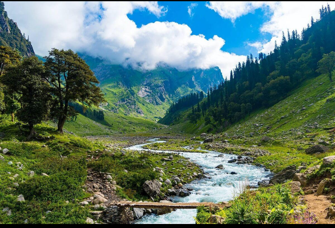
Himachal Pradesh literally the “Land of Snows” is not one ethnic community in the sense that a single caste or sect is, but a geography-defined population: the inhabitants, past and present, of a compact but extraordinarily varied stretch of the western Himalaya. With close to 7.5 million residents spread across just 55,673 square kilometres, Himachal Pradesh is one of India's smaller states by population, yet its people encompass an unusually wide range of ancestry, language, and custom packed into a landscape that rises from sub-tropical foothills at 350 metres to trans-Himalayan cold desert above 6,800 metres. This profile treats “Himachal Pradesh” as a geography-of-origin community in the genealogical sense: the shared population of a defined Himalayan territory, encompassing its many hill castes, tribal groups, religious communities, and valley-by-valley identities, whose ancestors have farmed, herded, traded, and migrated across these mountains for millennia.
Bordered by Jammu and Kashmir and Ladakh to the north, Tibet (China) to the east, Uttarakhand to the southeast, Haryana to the south, and Punjab to the west, Himachal Pradesh sits astride the historic frontier between the Indo-Gangetic plains and the Tibetan plateau. Its valleys and towns Kangra, Kullu, Chamba, Bilaspur, Sirmaur, Shimla, and the high borderlands of Kinnaur, Lahaul, and Spiti have at different points in history been small independent hill kingdoms, Mughal tributaries, Gorkha-occupied territory, British colonial hill stations, and, since 1971, a full-fledged Indian state popularly known as ‘Dev Bhoomi’, the Land of the Gods. It is at once the traditional homeland of ancient Himalayan tribes named in the Mahabharata, the meeting ground of Vedic Hindu and Tibetan Buddhist civilisation, the site of the Raj-era summer capital of Shimla, and, in modern times, one of India's most prosperous and highest-literacy hill states.
2. Geography
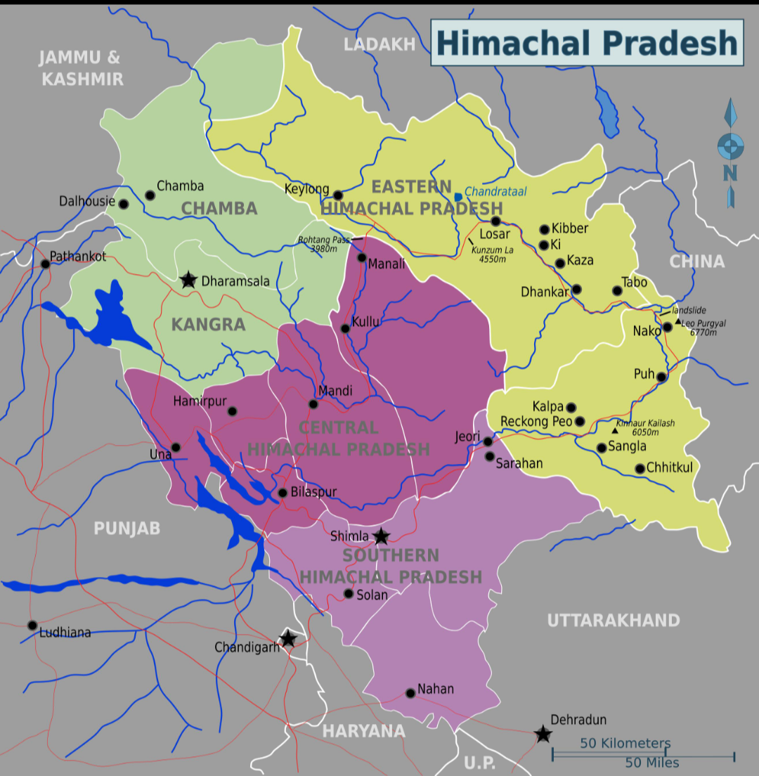
Himachal Pradesh covers 55,673 square kilometres of the Western Himalaya, of which roughly 27.7 per cent is under forest cover. Altitude within the state ranges from about 350 metres in the Una plains near Punjab to 6,975 metres at Reo Purgyil in Kinnaur, the state's highest peak, producing an unusually compressed sequence of climatic zones: a wet sub-tropical belt in the Kangra and Una lowlands; a humid sub-temperate zone across Shimla, Kullu, Solan, and parts of Mandi and Chamba; a dry temperate alpine zone across Lahaul-Spiti, Pangi, and Kinnaur; and a trans-Himalayan cold desert in the higher reaches of Lahaul and Spiti and Kinnaur, ecologically closer to Tibet than to the Indian plains.
The state's great rivers the Chenab (formed by the Chandra and Bhaga in Lahaul), the Ravi (rising at Bara Bhangal in Kangra), the Beas (rising near Manali and flowing through the Kullu valley), the Sutlej (flowing down from Tibet through Kinnaur and the Shimla hills), and the Yamuna (forming part of the southeastern boundary with Uttarakhand) carve the state into a series of parallel valleys separated by the Dhauladhar, Pir Panjal, and Zanskar mountain ranges. Himachal Pradesh is administratively divided into 12 districts Bilaspur, Chamba, Hamirpur, Kangra, Kinnaur, Kullu, Lahaul and Spiti, Mandi, Shimla, Sirmaur, Solan, and Una grouped into three revenue divisions (Kangra, Mandi, and Shimla). Shimla serves as the state's summer capital and Dharamshala as its winter capital. Lahaul and Spiti, at 13,835 square kilometres, is the largest district by area but, owing to its harsh high-altitude terrain, the least populated; Hamirpur, at just 1,118 square kilometres, is the smallest district by area but among the most densely populated and most literate.
2.1 Cultural-Geographic Sub-Regions
Long before the present district map, the people of Himachal identified themselves with older hill tracts and former princely territories, each carrying its own dialect, dress, and historical character:
| Region | Districts / Location | Notable Centres | Character |
|---|---|---|---|
| Kangra Valley & Lower Himachal | Kangra, Una, Hamirpur, Bilaspur, lower Mandi, parts of Chamba | Dharamshala, Kangra, Palampur, Una, Hamirpur | Sub-tropical to temperate foothill belt; tea gardens; Kangra school of miniature painting; McLeodganj, seat of the Tibetan government-in-exile |
| Mahasu / Upper Himachal (Shimla Hills) | Shimla, Solan, Sirmaur, upper Mandi, parts of Kinnaur, Bara Bhangal (Kangra) | Shimla, Solan, Nahan, Rampur Bushahr | Former colonial summer capital region; apple-growing mid-hills; Mahasu Pahari and related dialects; centre of hill ‘devta’ (deity) worship |
| Chamba | Chamba district | Chamba town, Bharmaur, Dalhousie, Pangi | Independent hill kingdom for close to a millennium; homeland of the Gaddi shepherd community; famed for Chamba Rumal embroidery |
| Kullu Valley | Kullu district | Kullu, Manali, Naggar | ‘Valley of Gods’; site of the Kullu Dussehra congregation of village deities; centre of Kullu shawl weaving |
| Kinnaur | Kinnaur district | Reckong Peo, Kalpa, Sangla, Chitkul | High-altitude Indo-Tibetan borderland; Kinnauri and Kinnauri-Pahari languages; blended Hindu-Buddhist ritual life |
| Lahaul and Spiti | Lahaul and Spiti district | Keylong, Kaza, Tabo | Trans-Himalayan cold desert; Tibetan Buddhist monastic culture; largest and least populated district |
3. Origins and Early History
3.1 Prehistoric Peoples and Ancient Tribes
Fossil remains of Ramapithecus in the Shivalik hills point to human and hominid presence in the region reaching back roughly a million years, while later prehistoric finds attest to sustained habitation through the Stone and early metal ages. Community tradition and Sanskrit literature name a succession of early hill peoples: the Kols or Mundas, generally regarded as the earliest identifiable settlers, concentrated especially in Kinnaur and Lahaul; the Kiratas, a Mongoloid people mentioned across Vedic and epic literature; and the Khasas, an Indo-Aryan tribe believed to have entered the western Himalaya from the northwest, intermarried with and absorbed earlier populations, and given the region's hill dialects their base, today grouped as Pahari. The Khasas are recorded in the Mahabharata, the Puranas, and the Brihat Samhita of Varahamihira as inhabitants of Shimla, Sirmaur, and parts of Kullu and Kinnaur; in Kinnaur today, some communities still identify as ‘Khashiya’ and trace a historical association with Rajput lineages. The Kinnaura or Kinner people of Kinnaur carry their own rich mythology, associated in the Puranas with celestial attendants of Kubera and, in local tradition, with the site of the Pandavas' exile in the Mahabharata.
The Mahabharata further records that the present-day state was once home to a cluster of small Himalayan republics or janapadas the Audumbras of the lower Kangra hills, the Trigarta kingdom drained by the Ravi, Beas, and Sutlej, the Kuluta kingdom of the upper Beas (Kullu) valley with its capital at Naggar, and the Kulinda republic between the Beas, Sutlej, and Yamuna reflecting a pattern of small self-governing hill polities rather than a single unified state.
3.2 Janapadas, Mauryas, and Guptas
By the fourth century BCE, a Himalayan chief named Parvataka, ruling territory between the Ravi and the Yamuna, is recorded as an ally of Chandragupta Maurya, and later Sanskrit sources describe Kirata, Kulinda, and Khasa hill tribes fighting alongside the Mauryan and Gupta armies. Ashoka's Buddhist patronage reached into the Himalayan foothills, and the Gupta emperor Samudragupta's fourth-century Allahabad Pillar inscription records that Himalayan hill rulers accepted his overlordship without war a pattern of loose tributary rather than direct rule that would recur throughout the region's pre-modern history. The Huna invasions of the fifth and sixth centuries CE are generally credited with weakening Gupta-era hill administration and opening the way for the rise of a new set of local Rajput dynasties.
3.3 Rajput Hill Kingdoms and Mughal-Era Independence
From roughly the ninth century onward, a mosaic of small Rajput-ruled hill states took shape across the region Kangra (under the Katoch dynasty, one of the oldest ruling lines in India), Chamba, Mandi, Suket, Bilaspur (Kahlur), Sirmaur, Kutlehar, Bushahr (Rampur), Baghal, and dozens of smaller principalities, many tracing their founding lineages to migrations from the Rajasthan-Gujarat-Punjab plains centuries earlier. Chamba in particular is notable for having preserved effective independence for close to a thousand years, its remoteness and rugged terrain repeatedly frustrating full Mughal conquest even as emperors such as Akbar and Aurangzeb sought to bring it to heel. Successive waves of hill-bound migration accompanied this period: the Gaddi shepherd community of the Bharmaur (Chamba) region, for instance, carries a well-preserved oral tradition of ancestors who fled Mughal-era religious persecution and political upheaval in the Punjab plains notably a folk couplet still recited today, ‘Ujarya Lahore te vasya Bharmaur’ (‘Ravaged from Lahore, settled in Bharmaur’) to found new communities in the high pastures around Kailash peak, which they venerate as the abode of their patron deity, Lord Shiva.
3.4 The Gorkha Invasion and British Rule
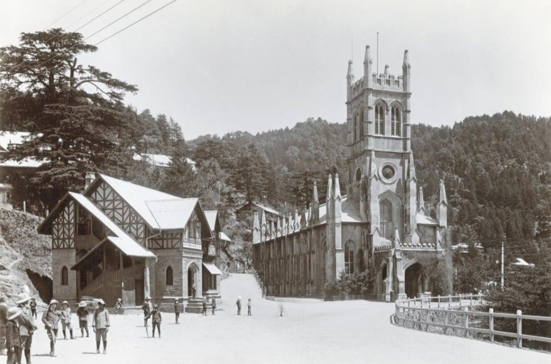
In the closing years of the eighteenth century, the Gorkha rulers of Nepal, having consolidated power under Prithvi Narayan Shah, began a westward campaign of conquest across the Himalayan hill states. Under General Amar Singh Thapa, Gorkha forces besieged and, in 1806, decisively defeated Raja Sansar Chand of Kangra (the Katoch ruler), annexing Sirmaur, the Shimla hill states, and large tracts of the region, though the fort of Kangra itself held out. Gorkha expansion was checked in the west by the Sikh Empire of Maharaja Ranjit Singh, who took control of Kangra fort, and their southward push brought them into direct conflict with the East India Company, triggering the Anglo-Gorkha War of 1814–1816. The British victory, formalised in the Treaty of Sugauli, expelled Gorkha power from the hill states west of the Kali river and established British paramountcy across the region; the hill kingdoms were retained as princely states under British protection, while Shimla, developed from the 1820s onward, rose to become the official summer capital of British India from 1864.
3.5 Post-Independence Himachal Pradesh
Following Indian independence in 1947, around 30 princely hill states of the region acceded to India and were unified on 15 April 1948 into the Chief Commissioner's Province of Himachal Pradesh. Bilaspur state, which had initially remained separate, merged into Himachal Pradesh on 1 July 1954. The territory became a Part C state in 1950 and a centrally administered Union Territory on 1 November 1956. A major territorial expansion followed the 1966 reorganisation of Punjab, when the hill districts of Kangra, Kullu, Lahaul and Spiti, Shimla, and other adjoining hill tracts of the former Punjab province were merged into Himachal Pradesh, giving the state roughly its present shape. Full statehood was finally granted on 25 January 1971, making Himachal Pradesh the eighteenth state of the Indian Union, with Dr Yashwant Singh Parmar the region's most prominent freedom fighter and architect of its integration as its first chief minister.
4. Demographic Profile
Himachal Pradesh's 2011 Census population stood at 6,864,602, up from about 6.08 million in 2001, with current estimates placing the population close to 7.5–7.9 million. Despite this growth, Himachal remains overwhelmingly rural, with close to 90 per cent of residents living in villages rather than towns the highest rural share of any major Indian state and a population density of only about 123 persons per square kilometre, among the lowest in the country, reflecting the state's mountainous terrain. The 2011 sex ratio stood at 972 females per 1,000 males, notably better than the national average of 943, and the state recorded an overall literacy rate of 82.8 per cent (89.5 per cent male, 75.9 per cent female) one of the highest literacy rates of any Indian state and a particular point of regional pride.
Religiously, the state is overwhelmingly Hindu, at roughly 95 per cent of the population as per the 2011 Census, with smaller Muslim (about 2.2 per cent), Sikh (about 1.2 per cent), Buddhist (about 1.2 per cent, concentrated in Lahaul-Spiti and Kinnaur), and Christian and Jain minorities. Scheduled Castes make up around a quarter of the population and Scheduled Tribes around 5.7 per cent, the latter concentrated in the officially designated tribal belts of Lahaul-Spiti, Kinnaur, Pangi (Chamba), and Bharmaur (Chamba), home to the Gaddi, Kinnaura, Lahaula, Pangwala, and Swangla communities among others. Kangra is the most populous district and Lahaul-Spiti the least populous; Hamirpur consistently records the highest population density and literacy rate in the state.
5. Genetics and DNA Ancestry
Himachal Pradesh's genetic landscape mirrors its geography: a state that runs from the Indo-Gangetic foothills to the Tibetan plateau carries correspondingly layered ancestry, from populations closely related to the wider North Indian gene pool in its lower and middle hills to populations sharing substantial East Asian and Tibetan ancestry in its high-altitude borderlands.
5.1 The ANI–ASI Gradient in a Himalayan Setting
Like the great majority of Indian populations, most residents of the Himachal mid-hills and lower valleys Kangra, Mandi, Shimla, Solan, Bilaspur, Una, Hamirpur, Chamba, and Sirmaur descend substantially from the same Ancestral North Indian (ANI) and Ancestral South Indian (ASI) admixture that characterises populations across the Indo-Gangetic belt. Genome-wide studies place this admixture at roughly 1,900 to 4,200 years ago across India, and populations of the western Himalayan foothills, situated on historic overland migration corridors linking Central Asia and the northwestern subcontinent to the Gangetic plain, characteristically show a comparatively higher ANI component than populations further south and east, broadly comparable to neighbouring hill and plains populations of Punjab, Haryana, and Uttarakhand.
5.2 Tibeto-Burman and East Asian Ancestry in the High Himalaya
The state's high-altitude tribal districts tell a genetically distinct story. Whole-genome sequencing of present-day individuals from Lahaul and Spiti and Kinnaur, published in a 2025 study of ancient and modern DNA at the northern Himalayan frontier, found that individuals from these districts occupy a genetic space intermediate between present-day East Asian and South Asian populations. Two sampled individuals from Kinnaur clustered together with Tibeto-Burman and Indo-European speakers of Nepal who carry high levels of ANI-ASI-related admixture, while showing a differing balance of ancestry components between them one shifted further toward the mainstream South Asian ANI-ASI cline, the other retaining a stronger East Asian and Tibetan-related signal. Individuals sampled from Lahaul and Spiti, by contrast, were found to derive the major share of their ancestry from Tibetan-related populations, with an additional, more ancient layer of Steppe-related (Afanasievo-linked) ancestry detected in some individuals reflecting the region's long history as a corridor of exchange between the Tibetan plateau and Central Asia. This pattern is consistent with the region's linguistic geography: Lahaul, Spiti, and parts of Kinnaur are home to Tibeto-Burman-speaking Buddhist communities culturally and genetically continuous with the Tibetan plateau, even as they remain politically and administratively part of Himachal Pradesh.
5.3 Y-Chromosome and Deep Ancestry
Broader studies of North Indian and western Himalayan Y-chromosome (paternal) lineages find the state's mid-hill populations carrying a mix of deep-rooted South Asian haplogroups (including H and L) together with haplogroups linked to the spread of Indo-Aryan and, in some lineages, later Central Asian populations (including R1a) a profile broadly shared with neighbouring Punjab, Haryana, and Uttarakhand. In the high-altitude tribal belt, paternal and maternal lineages linked to Tibetan and wider East Asian populations become progressively more prominent moving north and east through Kinnaur into Lahaul and Spiti, reflecting many centuries of trans-Himalayan trade, pilgrimage, and intermarriage across the passes connecting these valleys to Tibet. Taken together, Himachal Pradesh is best understood not as a single genetically uniform population but as a west-to-east and low-to-high altitude gradient, layering a broadly North Indian ANI-ASI genetic base in the foothills and mid-hills with an increasingly Tibetan and East Asian genetic signature in the state's trans-Himalayan tribal districts.
6. Language
Hindi is Himachal Pradesh's sole official language, but everyday speech across the state is carried by a remarkably dense cluster of local languages and dialects, collectively grouped as Pahari or Himachali and belonging chiefly to the Western Pahari branch of Indo-Aryan, alongside a set of unrelated Tibeto-Burman languages in the high borderlands. Mahasu Pahari is spoken across the Shimla hills; Kullui in the Kullu valley; Mandeali in Mandi; Kangri in the Kangra valley; Chambeali and the related Gaddi (Gaddiyali or Bharmauri) language in Chamba district, the latter spoken by around 180,000 people; Sirmauri in Sirmaur; and Bilaspuri and Hamirpuri in the corresponding districts each historically written, where written at all, in the local Takri script, though Devanagari has largely displaced it today. In the high Himalaya, Kinnaur district alone is home to nine distinct languages, of which Pahari Kinnauri (also called Kinnauri Pahari or Oras Boli) is the sole Indo-Aryan member, spoken by scheduled-caste communities of the district, while the remaining Kinnauri languages belong to the Tibeto-Burman family; Lahaul and Spiti likewise host Tibeto-Burman languages such as Spiti Bhoti, closely related to Tibetan. This linguistic layering the Indo-Aryan Pahari belt of the lower and middle hills giving way to Tibeto-Burman speech in the high borderlands closely mirrors the region's genetic and cultural gradient described above.
7. Religion, Festivals, and Pilgrimage
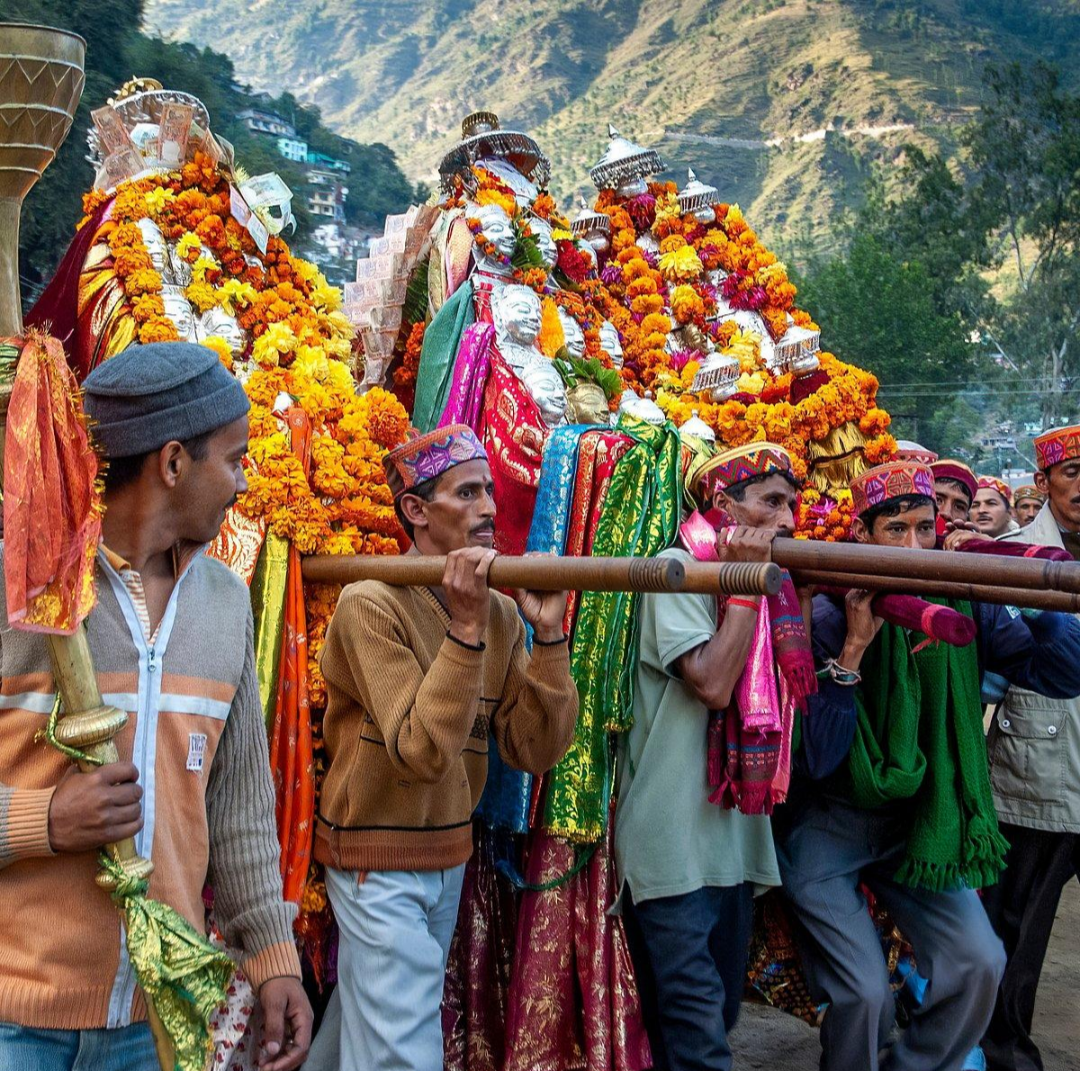
Himachal Pradesh's popular epithet, ‘Dev Bhoomi’ (Land of the Gods), reflects a religious landscape saturated with local deity worship layered onto mainstream Hinduism, alongside a significant Tibetan Buddhist presence in the north. Village and valley life across the mid-hills revolves around the cult of the local devta or devi hundreds of distinct deities, each with their own temple, oracle, palanquin, and annual festival calendar, many housed in wooden Kath-Kuni temple towers. The Kullu valley is famed as the meeting ground for this deity culture: each October, several hundred local gods and goddesses are ceremonially carried in palanquins to Dhalpur ground in Kullu town for the week-long Kullu Dussehra, a tradition said to date to 1651 and centred on the deity Raghunath, distinct from the Ravana-burning Dussehra celebrated elsewhere in India. Other major fairs include the Mandi Shivratri fair, drawing over 200 local deities to Paddal ground; the Minjar fair of Chamba, marking the monsoon harvest with an offering of silk tassels to the Ravi river; and the Lavi trade fair of Rampur Bushahr, a centuries-old Himalayan trading tradition.
In the high-altitude districts of Lahaul and Spiti and parts of Kinnaur, Tibetan Buddhism is the dominant tradition, centred on ancient monasteries such as Tabo (founded in 996 CE) and Key in Spiti, and on the Tibetan exile settlement and monastery complex at McLeodganj near Dharamshala, seat of the 14th Dalai Lama and the Central Tibetan Administration since 1960. Losar, the Tibetan lunar new year, is the principal festival of this belt, alongside masked Cham dances and monastery fairs. Kinnaur, on the border of these two worlds, is known for a distinctive syncretism in which many communities honour both Hindu deities and Buddhist figures within the same ritual calendar. Sikh, Muslim, and Christian minorities maintain their own places of worship, notably the historic Gurdwara at Paonta Sahib in Sirmaur, associated with Guru Gobind Singh.
8. Culture, Customs, and Social Practices
Social organisation in the Himachal hills has historically rested on a caste hierarchy broadly comparable to the wider North Indian pattern land-owning and priestly Brahmin and Rajput (Thakur, Rana, Mian) lineages, many tracing descent from the former ruling houses of the hill states, alongside artisan and service castes and Dalit communities such as Koli, Chamar, and Lohar groups but overlaid with a distinct set of hill and tribal identities found nowhere else in this combination: the Gaddi shepherds of Chamba and Kangra, transhumant pastoralists who drive their sheep and goat flocks between high summer pastures and low winter grazing grounds each year; the Kinnaura of Kinnaur; the Lahaula, Pangwala, and Swangla communities of Lahaul and Pangi; and the Gujjar pastoralist community found in the lower hills. Joint or extended-family living, with married sons often remaining within the parental household and land held jointly among brothers, has historically been the social norm across rural Himachal, and clan (khandan) and village-deity affiliation remain significant markers of local identity.
A once well-documented, though now rare, social institution in parts of the high-altitude tribal belt particularly Kinnaur, Lahaul, and adjoining border tracts was fraternal polyandry, in which brothers of a household jointly married a single wife, a practice anthropologists have linked to the need to keep scarce agricultural landholdings undivided in a harsh, low-yield mountain environment; it has become uncommon in recent decades with changing economic conditions and legal reform, though its memory remains part of the region's documented social history. Community hospitality, seasonal transhumance, and a strong tradition of communal labour-sharing (such as reciprocal help during harvest, house-building, and wool-shearing) continue to characterise rural social life across the hill districts.
9. Marriage and Wedding Traditions
Hindu weddings across most of Himachal Pradesh follow the broad North Indian Vedic pattern tilak (formal betrothal), haldi, mehndi, a baraat procession, phere around the sacred fire, and vidaai but carry distinctive hill inflections shaped by altitude and community. In many mid-hill communities, weddings historically featured the palanquin-borne bride (doli) carried over mountain paths between villages, folk wedding songs sung by women of the household, and community feasting drawn from the region's distinctive festive cuisine (see Section 10). Marriage has traditionally been arranged within caste and, for much of the rural population, subject to gotra (clan) and village-exogamy rules similar to those of the neighbouring plains. Among the Gaddi community, weddings retain particular customs tied to pastoral life, including ceremonial dress specific to the community and rituals invoking Lord Shiva, the community's patron deity. In the Buddhist high-altitude belt of Lahaul, Spiti, and parts of Kinnaur, wedding customs draw on Tibetan Buddhist ritual practice, including monastic blessings and, historically, fraternal polyandrous unions of the kind noted above a marked departure from the monogamous norm of the lower hills and an illustration of how sharply local custom can vary within a single state.
10. Cuisine
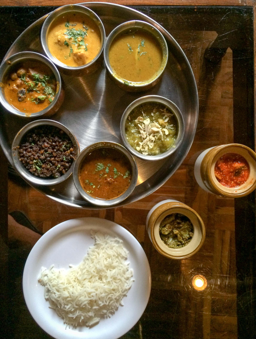
Himachali food culture is shaped above all by altitude and climate: hearty, warming, and often built around locally grown lentils, wheat, and dairy in the mid-hills, giving way to barley, buckwheat, and dried or preserved foods suited to the short growing season of the high Himalaya.
- Dham — the signature festive feast of the Himachal hills, traditionally prepared by hereditary cooks known as botis and served on leaf-plates called pattal at weddings, festivals, and community celebrations; a typical dham features rice, rajma or black gram, a yoghurt-based curry called madra, and a sequence of vegetarian courses served ceremonially to guests seated on the floor.
- Siddu — a fermented, steamed wheat-flour bread, sometimes stuffed with poppy seed, walnut, or lentil filling, traditionally cooked over an open fire and finished with steam; closely associated with Kullu, Manali, and the upper hill districts, and typically served with ghee or meat curry.
- Madra — chickpeas, kidney beans, or vegetables slow-cooked in a thick, spiced yoghurt gravy; a staple of the dham feast and everyday hill cooking alike.
- Babru — a Himachali variant of the kachori, stuffed with a spiced black-gram (urad dal) paste and especially popular in Shimla.
- Chha gosht and Kullu trout — meat dishes of the Kullu-Manali belt, the latter drawing on the region's cold, fast-flowing trout streams.
- Patrode, khatta, and bhey — colocasia-leaf rolls, tangy pumpkin or vegetable preparations, and lotus-stem dishes that round out the everyday and festive vegetarian repertoire of the mid-hills.
- High-altitude fare — in Lahaul, Spiti, and Kinnaur, barley and buckwheat replace much of the wheat and rice of the lower hills, alongside Tibetan-influenced dishes such as thukpa (noodle soup) and momos, dried apricots and their oil, and chhang, a fermented barley or millet beverage, reflecting the region's proximity to and cultural continuity with Tibet.
Everyday staple foods across rural Himachal centre on wheat and maize rotis, rice, lentils, seasonal hill vegetables, and dairy, while the state's temperate orchards, especially in Shimla, Kullu, and parts of Mandi and Kinnaur, have in the past century made it one of India's principal apple-producing regions, alongside significant production of other stone fruit, walnuts, and, at altitude, dry fruit.
11. Traditional Dress and Ornaments
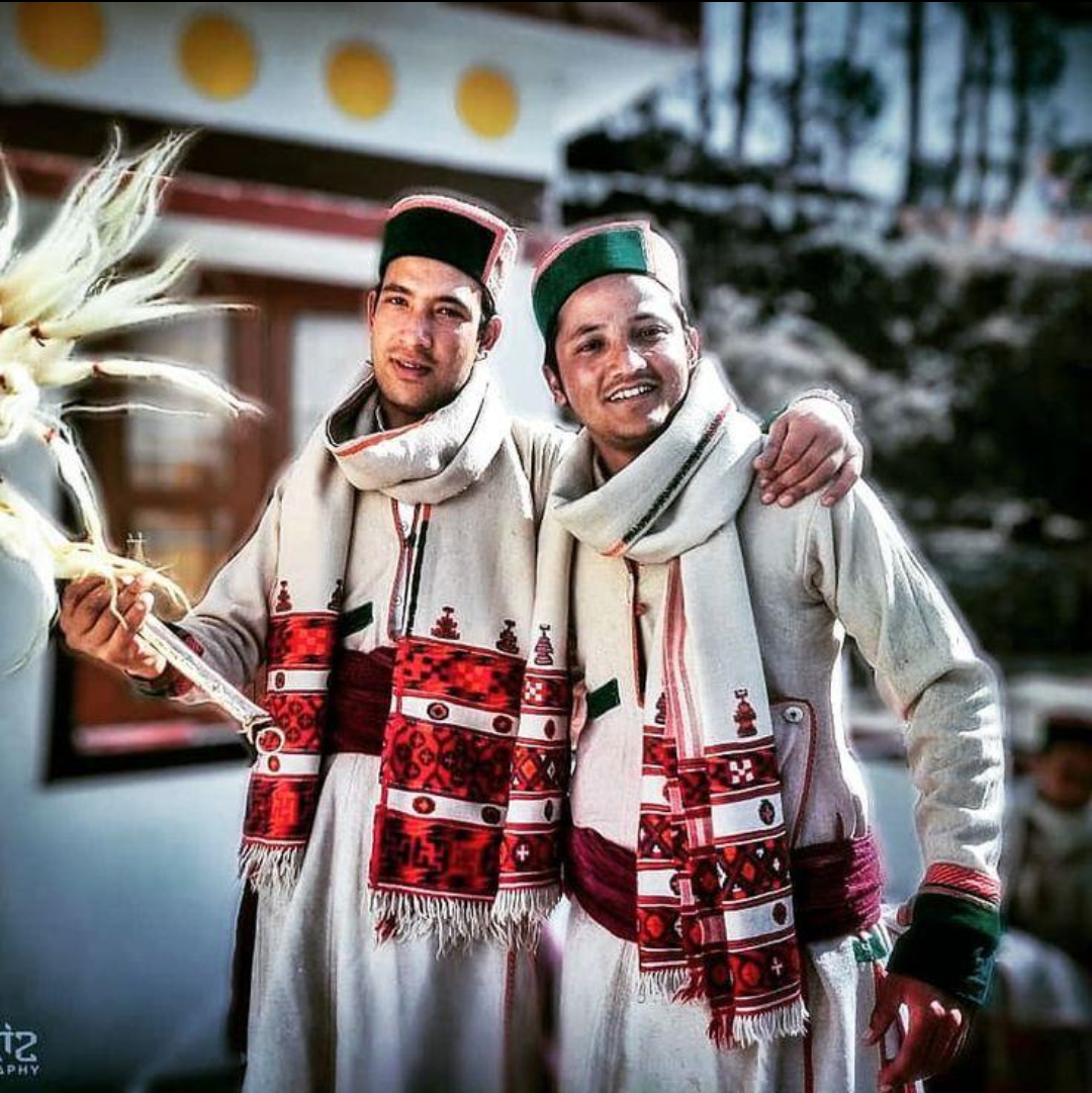
Traditional Himachali dress is built, above all, around wool, reflecting a cold mountain climate and a long-standing local sheep and goat husbandry economy, but its specific forms vary markedly from valley to valley.
- The Himachali topi — a flat, boat-shaped woollen cap trimmed with a green velvet band and, on formal versions, a golden brooch, worn by men across much of the state and among the most recognisable regional symbols; local variants include the Kullu cap with its patterned band and the Kinnauri and Bushehri topis of the higher districts.
- The pattu or pattoo — a thick, often intricately woven woollen shawl or wrap worn by women across the hill districts, draped over a salwar-kameez or, in Kullu, over a dress called the patto or dhati; the Kullu shawl, with its bright geometric borders, and the fine Kinnauri shawl, woven with elaborate motifs, are celebrated handicraft traditions in their own right.
- Kinnauri dress — women traditionally wear a wraparound woollen dress called the dohru with a pattoo shawl and a white waist-cloth (gachi), completed with heavy silver jewellery (chanki, khul-kanta) and grass or hemp footwear known as pullans; men wear a thick woollen robe called the chhuba with a green-bordered cap.
- Gaddi dress — Gaddi shepherds traditionally wear a long woollen robe called the chola tied with a long woollen cord (dora) that also serves to carry lambs, with woollen trousers (suthan) beneath, distinctive pointed caps, and, for women, colourful frocks called luancha or kadds worn with a headscarf; leather footwear known as mocharu completes the ensemble.
- Regional variation — Kullu's chola and topi, Shimla's reshta (an ankle-length dress) and Shimla cap, and Mandi's ghagra-choli with pishwaz each mark out a distinct local silhouette, while woollen products more broadly loi and chaddar shawls, gudma and namda rugs, and Kullu caps remain widely produced hill handicrafts.
12. Traditional Housing and Architecture
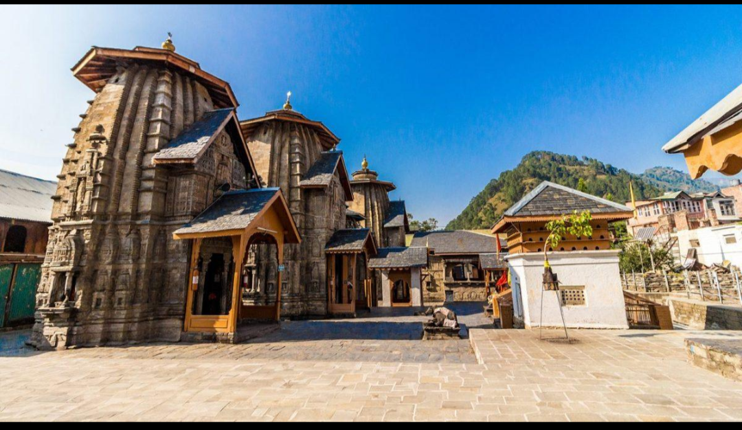
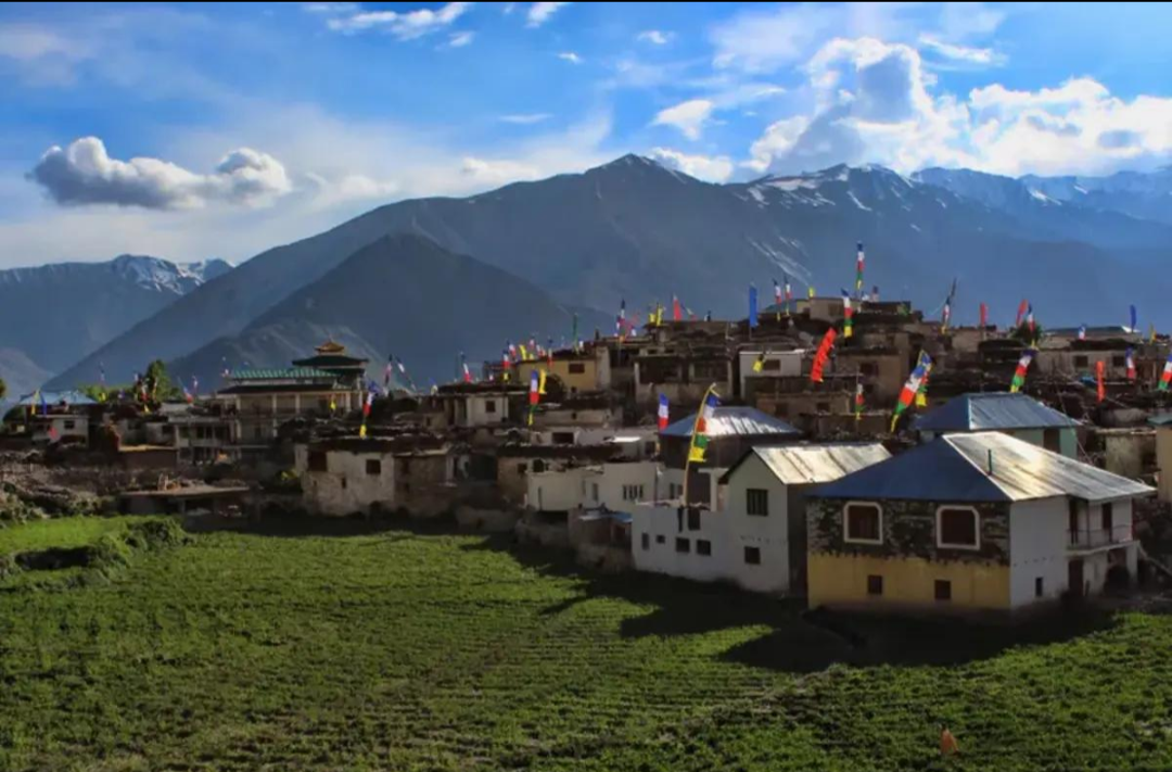
The most distinctive built heritage of the Himachal hills is Kath-Kuni (also Kath-Khuni) construction, a vernacular technique that alternates layers of locally sourced deodar or kail timber with dry stone masonry, laid without mortar in an interlocking cator-and-cribbage pattern. Developed over centuries in response to the region's seismic activity, heavy snowfall, and locally available materials, Kath-Kuni buildings can range from modest two- or three-storey farmhouses to elaborate temple towers rising to seven storeys, and the technique underlies many of the state's most important religious and royal buildings, including the Bhimakali temple at Sarahan, once the seat of the Bushahr royal family, and the historic Naggar Castle in Kullu. Rural houses typically cluster around a central hamlet and village temple dedicated to the local devta, reflecting the close link between settlement pattern and deity worship described above. In the high-altitude Buddhist belt of Lahaul, Spiti, and parts of Kinnaur, flat-roofed, whitewashed stone and mud-brick houses better suited to a cold, low-precipitation climate replace the sloped, timber-heavy construction of the wetter mid-hills, and are frequently clustered around monastery complexes.
13. Education, Livelihoods, and Jobs
Himachal Pradesh has long combined a largely agrarian, mountain-adapted economy with an unusually strong record on education and human development for a Himalayan state. Traditional livelihoods rest on terraced hill agriculture (maize, wheat, and rice in the lower valleys; barley and buckwheat at altitude), sheep and goat pastoralism especially among the Gaddi community, and, since the mid-twentieth century, commercial horticulture. Apple cultivation, expanded dramatically from roughly 400 hectares in 1950 to well over 100,000 hectares today, above all in Shimla, Kullu, Kinnaur, and parts of Mandi and Chamba, now anchors the rural cash economy, generating several thousand crore rupees in annual income and directly or indirectly employing several hundred thousand people; other stone fruit, off-season vegetables, and hill tourism have diversified this base further, alongside a substantial hydropower sector drawing on the state's snow-fed rivers.
Government service and, above all, the Indian armed forces occupy an unusually prominent place in Himachal's employment landscape at least one member of many rural hill families has traditionally served in the army or paramilitary forces, and the state is often described, especially in its Kangra, Hamirpur, Mandi, and Una belt, as having historically run on a ‘money order economy’ sustained by soldiers' remittances, with well over a hundred thousand ex-servicemen and tens of thousands of serving personnel resident in the state at any time. Himachal Pradesh, together with neighbouring Uttarakhand, is also one of the principal Indian recruiting grounds (alongside Nepal itself) for the Indian Army's Gorkha regiments, whose recruits train at the historic Gorkha Training Centre at Sabathu in the state. The state's near-universal literacy and strong record on school education have in turn fed a significant outward flow of educated professionals doctors, engineers, teachers, and administrators into cities across India and abroad.
14. Diaspora and Migration
Unlike several other Indian regions with a long history of indentured or plantation-era emigration, Himachal Pradesh's population movement has historically been dominated by circular and temporary migration rather than permanent overseas settlement, a pattern recent migration research attributes to the state's relatively favourable land-holding structure, its comparatively strong rural infrastructure, and the availability of steady government, defence, and horticultural employment within the state and in nearby Indian cities. Historically, the mountainous terrain of the region also functioned as a zone of refuge, drawing migrants from the northern plains during periods of political instability the same dynamic that, as noted in Section 3, is credited with the medieval settlement of communities such as the Gaddis in the Chamba hills.
Modern out-migration from Himachal runs along two principal channels: service in the Indian Army and paramilitary forces, which has historically drawn young men from across the hill districts (and, in a related stream, seasonal or career service in the British Army and Singapore Police as part of the wider Gorkha recruitment tradition centred on Sabathu); and, increasingly since the late twentieth century, skilled and professional emigration doctors, engineers, academics, hospitality professionals, and students to metropolitan India and, more recently, to the United States, the United Kingdom, Canada, Australia, and the Gulf states, alongside a substantial seasonal and permanent migration of horticultural labour and orchard workers into and within the state during the apple season. Himachali cultural and regional associations (pravasi Himachali samitis) are active in several major Indian cities and in parts of the wider diaspora, maintaining ties to home-district devta festivals, Pahari language and cuisine, and hometown philanthropic causes.
15. Prominent Figures
Politics and Public Life
- Dr Yashwant Singh Parmar (1906–1981) — born in Sirmaur district; the leading architect of Himachal Pradesh's post-Independence integration and the state's first chief minister, serving multiple terms between 1952 and 1977.
- Virbhadra Singh (1934–2021) — scion of the former Bushahr royal family and Himachal's longest-serving chief minister, holding the office across six terms between 1983 and 2017.
- Shanta Kumar — veteran BJP leader, writer, and two-time chief minister of Himachal Pradesh.
- Prem Kumar Dhumal — twice chief minister of Himachal Pradesh (1998–2003, 2008–2012).
- Jagat Prakash Nadda — Union Cabinet minister and former national president of the Bharatiya Janata Party, from Himachal Pradesh.
- Anand Sharma and Anurag Thakur — prominent Union ministers and parliamentarians from the state in recent decades.
Defence
- Major Somnath Sharma (1923–1947) — from Kangra district; the first-ever recipient of the Param Vir Chakra, India's highest wartime gallantry award, for his defence of Srinagar airport in 1947.
- Captain Vikram Batra (1974–1999) — from Palampur, Kangra district; posthumous Param Vir Chakra recipient for gallantry during the 1999 Kargil War, remembered for his call sign ‘Yeh Dil Maange More’.
- Havildar Sanjay Kumar — from Bilaspur district; Param Vir Chakra recipient for the 1999 Kargil War.
- Jemadar Lala Ram and Honorary Captain Bhandari Ram — early twentieth-century Victoria Cross recipients from Hamirpur and Bilaspur districts respectively.
- General Vishwa Nath Sharma — 14th Chief of the Army Staff of the Indian Army (1988–1990).
Arts, Entertainment, and Other Fields
- Kangana Ranaut — Bollywood actress and filmmaker, from Bhambla village near Mandi.
- Preity Zinta — Bollywood actress, from Shimla.
- Yami Gautam — Bollywood actress, from Bilaspur district.
- Sardar Sobha Singh — noted painter associated with the artists' colony of Andretta in Kangra district.
- Shriniwas Joshi — Shimla-based writer and theatre personality closely associated with Himachali literary life.
16. Conclusion
Himachal Pradesh represents an unusually compressed case of a geography whose ancient tribal memory, medieval hill-kingdom politics, colonial hill-station history, and modern population genetics all trace back to a single organising fact: altitude. From the Khasa and Kirata tribes of Sanskrit tradition to the Rajput hill kingdoms that resisted Mughal conquest for centuries, from the Gorkha invasion and British Shimla to the 1948 merger of thirty princely states into a single administrative unit and full statehood in 1971, the region's political history has repeatedly been shaped by its mountainous terrain as much as by the dynasties that ruled it. That same terrain has produced a genetically and culturally layered population a broadly North Indian ANI-ASI ancestry across the Kangra, Mandi, and Shimla hills shading, through Kinnaur, into a substantially Tibetan and East Asian genetic signature in Lahaul and Spiti; a Pahari-Hindu religious and linguistic world giving way to Tibetan Buddhist monastic culture at altitude; and a single state that is at once the wool-and-pattu country of the Gaddi shepherd, the apple orchards of Shimla and Kinnaur, the Param Vir Chakra soldiers of Kangra and Bilaspur, and the high Buddhist monasteries of Spiti. From the Kath-Kuni temple towers of Sarahan to the deity palanquins of Kullu Dussehra, and from the dham feast served on a leaf-plate to the barley chhang of a Lahauli winter, the story of Himachal Pradesh's people is simultaneously a religious history, a genetic case study, and a living regional culture carried across one of India's most varied mountain landscapes.
Frequently Asked Questions
What ethnicity or ancestry are people from Himachal Pradesh?
People from Himachal Pradesh are not a single ethnicity but a geographically layered population encompassing Rajput, Brahmin, and other hill castes, the Gaddi shepherd community, the Kinnaura and Lahaula peoples of the high Himalaya, and smaller pastoral and artisan communities. Genetically, populations in the state's lower and middle hills descend chiefly from the same Ancestral North Indian (ANI) and Ancestral South Indian (ASI) admixture found across North India, while populations in the high-altitude districts of Lahaul, Spiti, and parts of Kinnaur carry a substantial and, in some individuals, dominant Tibetan and East Asian genetic component, reflecting the region's role as a frontier between South Asia and the Tibetan plateau.
Is Himachal Pradesh Aryan or Tibetan in ancestry?
Neither label fits the state as a whole. The majority of Himachal's population, in the Kangra, Mandi, Shimla, Solan, Bilaspur, Una, Hamirpur, Chamba, and Sirmaur belt, speaks Indo-Aryan Pahari dialects and carries a genetic profile broadly continuous with neighbouring North Indian populations. In the trans-Himalayan districts of Lahaul and Spiti and in much of Kinnaur, however, Tibeto-Burman languages are spoken and a substantial share of genetic ancestry is Tibetan-related, making the state, taken as a whole, a genuine frontier zone between the two broad ancestries rather than belonging wholly to either.
What DNA haplogroups are found among people from Himachal Pradesh?
Studies of the state's mid-hill populations report a mix of deep South Asian paternal haplogroups such as H and L alongside haplogroups linked to Indo-Aryan and Central Asian-associated migration, including R1a, broadly similar to neighbouring Punjab, Haryana, and Uttarakhand. In the high-altitude tribal belt of Kinnaur, Lahaul, and Spiti, paternal and maternal lineages associated with Tibetan and East Asian populations become progressively more common, with recent whole-genome studies also identifying a deeper, more ancient layer of Steppe-related (Afanasievo-linked) ancestry among some individuals in this belt.
What language do people in Himachal Pradesh speak?
Hindi is the state's official language, but everyday speech is carried by a dense cluster of local Pahari dialects, including Kangri, Mandeali, Kullui, Chambeali, Sirmauri, and Mahasu Pahari, most belonging to the Western Pahari group of Indo-Aryan languages. In the high-altitude districts of Kinnaur, Lahaul, and Spiti, a separate set of Tibeto-Burman languages is spoken (including several distinct Kinnauri languages and Spiti Bhoti), closely related to Tibetan rather than to the Pahari dialects of the lower hills.
What is the traditional dress of Himachal Pradesh?
The best-known symbol of Himachali dress is the flat, green-bordered woollen Himachali topi worn by men, paired with a kurta and, in cold weather, a woollen coat or waistcoat. Women traditionally wear a woollen pattu or pattoo shawl over a salwar-kameez or local dress, with district-specific variations such as the dohru wraparound dress and heavy silver jewellery of Kinnaur, or the chola robe and distinctive headgear of the Gaddi shepherd community.
What is Himachal Pradesh famous for in terms of food?
Himachal Pradesh is best known for dham, a festive multi-course vegetarian feast served at weddings and celebrations by hereditary cooks and eaten off leaf-plates, along with dishes such as siddu (steamed stuffed wheat bread), madra (a yoghurt-based curry), and babru. Its apple orchards, concentrated in Shimla, Kullu, and Kinnaur, are also a major source of regional identity and income, and its high-altitude districts contribute Tibetan-influenced dishes such as thukpa and momos alongside dried apricots and barley-based chhang.
Where do people from Himachal Pradesh migrate to for work?
Unlike several Indian regions with a history of indentured overseas emigration, Himachal's migration has historically been temporary and circular rather than permanent, driven above all by government service, defence and paramilitary recruitment, and, more recently, professional and educational emigration. The state is a major recruiting ground for the Indian Army's Gorkha regiments (trained at Sabathu) and more broadly supplies a disproportionate number of soldiers and ex-servicemen relative to its population; in recent decades, skilled emigration of doctors, engineers, and hospitality professionals to Indian metros and countries such as the United States, United Kingdom, Canada, Australia, and the Gulf states has grown alongside this older pattern.
What caste and community groups are found in Himachal Pradesh?
Himachal's Hindu population spans land-owning Rajput and Brahmin lineages descended in many cases from former hill-state ruling families, artisan and service castes, and Dalit communities such as Koli and Chamar groups. Alongside this caste spectrum, the state recognises several Scheduled Tribe communities concentrated in its high-altitude and border districts, chiefly the Gaddi shepherds of Chamba and Kangra, the Kinnaura of Kinnaur, and the Lahaula, Pangwala, and Swangla communities of Lahaul and Pangi, alongside Gujjar pastoralists in the lower hills.
Is Himachal Pradesh genetically similar to Punjab, Uttarakhand, or Tibet?
The answer depends on which part of the state is being considered. Himachal's mid-hill and foothill populations Kangra, Mandi, Shimla, Bilaspur, Una, Hamirpur, and Sirmaur are genetically closest to neighbouring Punjab, Haryana, and the hill populations of Uttarakhand, consistent with shared Indo-Aryan Pahari language and a common North Indian ANI-ASI ancestry. The high-altitude districts of Lahaul, Spiti, and much of Kinnaur, by contrast, show a genetic affinity that shifts substantially toward Tibetan and wider East Asian populations, making this part of the state a distinct genetic zone bridging South Asia and the Tibetan plateau.
What is ‘Dev Bhoomi’ and why is Himachal Pradesh called that?
‘Dev Bhoomi’, or ‘Land of the Gods’, is a popular epithet for Himachal Pradesh reflecting the region's dense tradition of local deity (devta and devi) worship, in which hundreds of village gods, each with a temple, oracle, and annual festival, remain central to social and religious life across the hills; the term also evokes the region's numerous ancient Hindu temples and its role, in the high Himalaya, as a centre of Tibetan Buddhist monastic practice.
What physical traits are typical of people from Himachal Pradesh?
There is no single physical type for a population spread across such an extreme range of altitude, language, and ancestry. In general, populations of the mid-hills and foothills show physical characteristics broadly typical of North Indian hill populations, while communities of the high-altitude tribal belt of Kinnaur, Lahaul, and Spiti more frequently display features associated with Tibetan and East Asian ancestry, consistent with the genetic gradient described above. As with any population of several million people spanning many castes, tribes, and religious communities, individual variation within each group is considerable, and no single physical description applies uniformly across the state.